| . |  |
. |
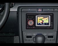
Barcelona, Spain (SPX) Jul 09, 2010 A research group from the UAB Department of Telecommunications and Systems Engineering at the School of Engineering, led by Jose Lopez Vicario and Antoni Morell, took part in the development of a new system which locates unoccupied car park spaces and guides users to the nearest one. The new network of sensors for the management of public car parks and locations, which researchers have named XALOC (Xarxes de sensors per a la gestio d'Aparcaments publics i LOCalitzacio), was developed by a consortium formed by the firm WorldSensing (consortium leader) and the Centre for Telecommunications Technology of Catalonia (CTTC). The project was financed by Catalan Government's Agency for Administration of University and Research Grants (AGAUR). The project's consortium developed a platform based on a network of wireless sensors capable of detecting unoccupied spaces outdoors, and on an alternative positioning system with more precision in urban areas than GPS technology. This platform is capable of locating and guiding drivers to car park spaces available in the area. The network's sensors are located on the ground directly in the middle of the car park space. The sensors detect whether the space is occupied or not and send information via internet to a central station. The server processes this information and sends it to indication panels located in the street which display the information in real time. Advanced communication techniques are used to send guidance data to the network. The sensor platform at the same time locates users looking to park and thus offers a personalised service. UAB researchers have designed a specific portable navigator for users called ARID Navigator which makes use of communication signals belonging to the network of sensors to position users within their urban surroundings. Once the vehicle is located, the navigator communicates with XALOC's central server and reports to the user the number of available car park spaces in the area and where they are located. The positioning and location technology used to develop the system is totally new and offers many advantages in comparison to conventional GPS navigators, such as more precise urban location techniques, reduced positioning time and better coverage. The XALOC system will improve traffic management in urban areas and reduce what is known as "agitated traffic", traffic caused by drivers circulating and looking for a place to park. Reducing the volume of agitated traffic will allow for a substantial improvement in circulation fluidity in urban areas and thus contribute to effective reductions in pollution and an increase in citizen satisfaction.
Share This Article With Planet Earth
Related Links Universitat Autonoma de Barcelona GPS Applications, Technology and Suppliers
 Global Number Of Traffic Information Users To Exceed 370 Million By 2015
London, UK (SPX) Jul 05, 2010 Traffic Information maintains its position as the most important feature of navigation services with the global number of traffic information users expected to grow from 57 million in 2010 to more than 370 million in 2015, according to the latest market data from ABI Research. Telematics and Navigation practice director Dominique Bonte comments: "Navigation users continue to appreciate the ... read more |
|
| The content herein, unless otherwise known to be public domain, are Copyright 1995-2010 - SpaceDaily. AFP and UPI Wire Stories are copyright Agence France-Presse and United Press International. ESA Portal Reports are copyright European Space Agency. All NASA sourced material is public domain. Additional copyrights may apply in whole or part to other bona fide parties. Advertising does not imply endorsement,agreement or approval of any opinions, statements or information provided by SpaceDaily on any Web page published or hosted by SpaceDaily. Privacy Statement |


 del.icio.us
 Digg
Digg Reddit
 YahooMyWeb
 Google