| . |  |
. |
|
|
. |
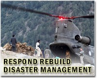
by Staff Writers Livermore, CA (SPX) Aug 22, 2011
Using iPad mobile devices, emergency preparedness officials and first responders participating last month in the Federal Emergency Management Agency's National Level Exercise 2011 (NLE-11)were able, for the first time, to make use of a new, science-based software tool that allows them to view and modify accurate models of building damage and other post-event disaster effects. With funding and direction from the Department of Homeland Security's Science and Technology Directorate (DHS/S and T) and support from FEMA's National Exercise and Simulation Center, Sandia National Laboratories has developed the tool, known as the Standard Unified Modeling, Mapping and Integration Toolkit (SUMMIT). It was piloted at the NLE-11 exercise. "Say you're a fireman, medic, or police officer and you're participating in an annual exercise to hone your preparedness skills," said Karim Mahrous, the SUMMIT project lead at Sandia. "Such drills, you realize, are vital in mitigating the damage that might arise from natural disasters or terrorist events. "Almost by definition, however, exercise planners have an inherent challenge in creating drill scenarios that can be vividly imagined and thus acted upon by participants," Mahrous continued. "Typically, first responders playing in an exercise must pretend and dream up how a damaged building might look. With SUMMIT, there's no more pretending." "The SUMMIT software tool, I believe, will be a phenomenal training aid for all responders within our county," said David Moore, director of emergency management for Craighead County in Arkansas, which played a key role at NLE-11. "By having a graphical view of damaged areas, it's much easier to comprehend what's going on in the exercise and thus make smarter, firmer decisions."
New level of realism and 'best-of-class' models This enhanced, 3-D virtual view of damage available to participants in the field is expected to create a new level of realism and a common operating picture for players in future exercises at national, regional, and local levels. "Preparing responders to work within a rapidly evolving, diverse, and multijurisdictional environment - often with limited or quickly changing situational understanding - is a major challenge," said Jalal Mapar, the DHS/S and T program manager who oversees the SUMMIT program. SUMMIT significantly improves the cycle of activities that emergency response teams undertake, including pre-event planning and equipping, training and exercises, and evaluation and improvement. By creating a collaboration environment that allows dynamic linking of "best-in-class" modeling and simulation tools and underlying data, SUMMIT enhances the effectiveness of preparedness activities while reducing the time and cost needed to train for, analyze, and respond to real or potential incidents. "Many organizations and government agencies have already made significant investments in modeling and simulation, so this is not meant to be yet another modeling tool," Mapar said. "What is urgently needed then is not a whole new set of models, but an easy, quick, and user-friendly way to access and link together the most appropriate models for a given emergency drill." Though current modeling tools are effective, they all incorporate different assumptions that currently require a large amount of time, resources, and human effort in order to properly synchronize each model's output.
Making SUMMIT a pervasive part of emergency response Using various models and calculations, SUMMIT can input details on buildings and infrastructure, casualties, and other key pieces of information. During exercises, it will visualize an integrated "story" that can be made available for all players in a master control cell, much like what occurred in Washington, DC, during NLE-11. The broader goal, said Mapar, is to make SUMMIT a pervasive part of preparedness and response for emergency managers, responders, and exercise teams in the federal, state, and local government.
|
. |
|
| The content herein, unless otherwise known to be public domain, are Copyright 1995-2011 - Space Media Network. AFP and UPI Wire Stories are copyright Agence France-Presse and United Press International. ESA Portal Reports are copyright European Space Agency. All NASA sourced material is public domain. Additional copyrights may apply in whole or part to other bona fide parties. Advertising does not imply endorsement,agreement or approval of any opinions, statements or information provided by Space Media Network on any Web page published or hosted by Space Media Network. Privacy Statement |

 del.icio.us
 Digg
Digg Reddit
 Google