| . |  |
. |
Bangkok (AFP) Aug 06, 2007 Thailand plans to launch its first environmental satellite in November to help officials survey natural resources, cope with disasters and even fight drug trafficking, an official said Monday. The Theos satellite, whose name stands for Thailand Earth Observation Systems, has been under study and construction for two years, according to Thai space official Charnchai Peanvijarnpong. "The satellite will help us predict the chances of droughts or floods," said Charnchai, who is deputy director of Geo-Informatics at the government's Space Technology Development Agency. The satellite will be able to monitor food crops but will also help counter-narcotics officials keep an eye on production of opium poppies and other illicit crops, he said. "It will help state officials in suppressing illegal logging and drugs trafficking, while estimating the size of a number of other crops," Charnchai told AFP. Several state agencies have already signed contracts to use the satellite's service, including the Royal Irrigation Department, the Office of Narcotics Control Board, the Natural Parks Department and the Defence Ministry, he said. The project cost about six billion baht (179 million dollars). Work on Theos was done in cooperation with European space company EADS Astrium, he said.
Source: Agence France-Presse Community Email This Article Comment On This Article Related Links Earth Observation News - Suppiliers, Technology and Application
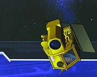
 Paris (ESA) Aug 02, 2007
How high is Mount Everest exactly? Recent surveys have come up with heights that differ by more than five metres. An expedition called the Geodetic Journey is making its way through China and Tibet to highlight the importance of geodesy and how an accurate model of the geoid from ESA's GOCE mission will lead to a unified system for measuring heights. Geodesy is concerned with measuring and mapping the shape of the Earth's surface, to the benefit of all branches of Earth sciences and has many practical applications. Although surveying techniques go back thousands of years, it traditionally involves taking very precise three-dimensional positioning of points. It is the means by which the surface of the Earth is mapped and is also essential in the field of engineering and construction. |
|
| The content herein, unless otherwise known to be public domain, are Copyright 1995-2006 - SpaceDaily.AFP and UPI Wire Stories are copyright Agence France-Presse and United Press International. ESA PortalReports are copyright European Space Agency. All NASA sourced material is public domain. Additionalcopyrights may apply in whole or part to other bona fide parties. Advertising does not imply endorsement,agreement or approval of any opinions, statements or information provided by SpaceDaily on any Web page published or hosted by SpaceDaily. Privacy Statement |