 The image, derived from SMOS data in July 2010, clearly shows the plume of fresh Amazon River water as it enters the Atlantic Ocean. Credits: I. Corbella, UPC / Google Earth |
The Soil Moisture and Ocean Salinity (SMOS) mission has been delivering observations of 'brightness temperature' to the science community since mid-July. As a measure of radiation emitted from Earth's surface, this information can be used to derive global maps of soil moisture every three days and maps of ocean salinity at least every 30 days.
By consistently mapping soil moisture and ocean salinity, SMOS will advance our understanding of the exchange processes between Earth's surface and atmosphere - the water cycle - and help improve weather and climate models. In addition, these data will be of practical use for agriculture and water resource management.
Soil moisture and ocean salinity data products will be released later this month, but scientists are very encouraged by what they are already seeing.
Talking about observations that relate to ocean salinity, Nicolas Reul from Ifremer said, "One of the dramatic steps forward achieved with SMOS is that we now have the ability to track the movement of low-salinity surface waters, particularly those resulting from large 'plumes' such as the Amazon.
"Observations between mid-July and mid-August clearly show how the North Brazilian Current transports fresh water from the Amazon River as the current flows across the mouth of the river. These observations confirm the excellence of the data we are already getting from SMOS."
Discharge from the Amazon River, the Amazon plume, amounts to around 15% of the global input of fresh water into the ocean. The migration of the plume, however, varies seasonally. During the first half of the year the river water generally disperses over a broad area to the northwest, towards the Caribbean Sea, but in the second half of the year the plume flows around the North Brazil Current and is carried back eastwards.
The migration of the Amazon plume results in significant differences in the salinity of the surface ocean water, so it was expected that SMOS would reveal the intricacies of these variations.
"Over the last weeks we have been able to track how the Amazon freshwater plume curves back on itself at this time of year as large North Brazilian Current eddies form northwest of the river mouth," said Dr Reul.
"At the same time, the Orinoco plume has also been clearly visible as a tongue of fresh water entering the Tropical Atlantic along the windward side of the Caribbean islands.
"These observations are a good example of how well SMOS is performing and they show us that the mission can provide data on temporal sea-surface variability at scales of less than a week."
Along with temperature, variations in ocean salinity drive global three-dimensional ocean-circulation patterns. This conveyor-like circulation is an important component of Earth's heat engine and crucial in regulating weather and climate. Ocean salinity data from SMOS are therefore expected to greatly improve our knowledge of the conditions that influence these circulation patterns and thus climate.
 del.icio.us del.icio.us |
 Digg Digg |
 Reddit Reddit |
 YahooMyWeb YahooMyWeb |
 Google Google |
|
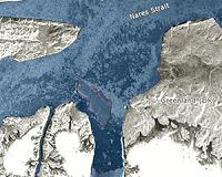 Earth From Space: Giant Iceberg Enters Nares Strait
| The content herein, unless otherwise known to be public domain, are Copyright 1995-2010 - SpaceDaily. AFP and UPI Wire Stories are copyright Agence France-Presse and United Press International. ESA Portal Reports are copyright European Space Agency. All NASA sourced material is public domain. Additional copyrights may apply in whole or part to other bona fide parties. Advertising does not imply endorsement,agreement or approval of any opinions, statements or information provided by SpaceDaily on any Web page published or hosted by SpaceDaily. Privacy Statement |