| . |  |
. |
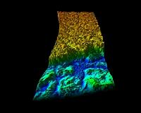
Paris, France (ESA) Sep 06, 2010 ESA's Envisat satellite has been tracking the progression of the giant iceberg that calved from Greenland's Petermann glacier on 4 August 2010. This animation shows that the iceberg, the largest in the northern hemisphere, is now entering Nares Strait - a stretch of water that connects the Lincoln Sea and Arctic Ocean with Baffin Bay. The Petermann glacier in northern Greenland is one of the largest of the country's glaciers - and until August it had a 70 km tongue of floating ice extending out into the sea. The glacier regularly advances towards the sea at about 1 km per year. Earlier this year, satellite images revealed that several cracks had appeared. Envisat radar images showed that the ice tongue was still intact on 3 August but, on 4 August, a huge chunk had detached. Calvings from the Petermann glacier are quite common, but one of this magnitude is rare. Less significant events took place in 2001, in 2008 when a 27 sq km iceberg made its way south to Davis Strait, and in 2009. This iceberg is about 30 km long and 15 km wide at its foot and almost 7 km wide at its head, covering an area of around 245 sq km. By 22 August this giant mass of ice had been carried about 22 km from its birth place. On 1 September imagery showed that the iceberg had travelled almost another 6 km from the edge of the glacier and rotated westward (about 39 degrees ), just tipping into Nares Strait. The animation also shows that the iceberg hit a small island, which may delay further progression for a short while and may also cause the iceberg to break. It is expected that the iceberg will soon be fully in Nares Strait, but its course depends on winds blowing off the glacier and currents in the strait, as well as sea ice that could block its path. The animation was generated from 21 Envisat Advanced Synthetic Aperture Radar (ASAR) Wide Swath Mode (spatial resolution 150 m x 150 m) and three ASAR Image Mode (spatial resolution 30 m x 30 m) images.
Share This Article With Planet Earth
Related Links ESA Envisat Earth Observation News - Suppiliers, Technology and Application
 Critical Polar Data Flows Briskly To Researchers
Washington DC (SPX) Sep 03, 2010 Operation IceBridge - a NASA airborne mission to observe changes in Earth's rapidly changing polar land ice and sea ice - is soon to embark on its fourth field season in October. The mission is now paralleled by a campaign to bring data to researchers as quickly as possible and to accelerate the analysis of those changes and how they may affect people and climate systems. "Anyone can acces ... read more |
|
| The content herein, unless otherwise known to be public domain, are Copyright 1995-2010 - SpaceDaily. AFP and UPI Wire Stories are copyright Agence France-Presse and United Press International. ESA Portal Reports are copyright European Space Agency. All NASA sourced material is public domain. Additional copyrights may apply in whole or part to other bona fide parties. Advertising does not imply endorsement,agreement or approval of any opinions, statements or information provided by SpaceDaily on any Web page published or hosted by SpaceDaily. Privacy Statement |


 del.icio.us
 Digg
Digg Reddit
 YahooMyWeb
 Google