| . |  |
. |
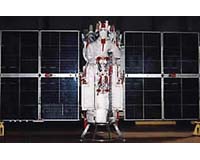
Moscow (RIA Novosti) Nov 14, 2006 Russia will lift all precision restrictions from 2007 in the use of military-controlled Glonass to enable accurate and unlimited commercial use of the global positioning system, the defense minister said Monday. Glonass, a Russian version of the U.S. Global Positioning System (GPS), is designed for both military and civilian purposes, and allows users around the globe to identify their positions in real time. It can also be used in geological prospecting. Sergei Ivanov said: "By January 1, 2007, the General Staff will lift all restrictions on the precision of coordinates, so that the system can be used to develop the economy and transportation system." Current restrictions limit the accuracy for civilian users of Glonass to 30 meters. Ivanov told a meeting between the Cabinet and the president that Glonass would cover all of Russia by the end of 2007, which would require 18 satellites. "The whole project is ready and has received support from the economics ministry," said Ivanov, who is also a deputy prime minister. Global application of the system by the end of 2009 will require 24 satellites, he said. "Today, 14 spacecraft are in orbit," Ivanov said, adding that another three satellites would be launched December 25. Ivanov also said a senior designer had been appointed for the system, "Yury Urlichich, who will be responsible for both the orbiting satellites and ground-based equipment." The defense minister also said his ministry and the Ministry of Economic Development and Trade would be in charge of the Glonass services market. The Russian Space Agency approved the Russian military's decision to put Glonass into commercial use. "We think that canceling restrictions for all Russian citizens using Glonass signals opens unlimited opportunities, and will encourage the development of the new and promising market of satellite navigation," spokesman Igor Panarin said. He said that Glonass services would be a luxury for most people in Russia to begin with. "But with time, every housewife will be able to place a portable satellite navigator on her dog's collar so that she can know where her pet is at any given moment," Panarin said.
Source: RIA Novosti Related Links GPS Applications, Technology and Suppliers  Beijing (XNA) Nov 14, 2006
China is expected to launch two navigation satellites early next year as part of a plan to build a global navigation positioning network, aerospace insiders say. The launch of the two "Beidou" (Compass) satellites, scheduled for the beginning of 2007, is expected to cover China and parts of neighbouring countries by 2008, before being expanded into a global system, the sources confirmed over the weekend. |
|
| The content herein, unless otherwise known to be public domain, are Copyright 1995-2006 - SpaceDaily.AFP and UPI Wire Stories are copyright Agence France-Presse and United Press International. ESA PortalReports are copyright European Space Agency. All NASA sourced material is public domain. Additionalcopyrights may apply in whole or part to other bona fide parties. Advertising does not imply endorsement,agreement or approval of any opinions, statements or information provided by SpaceDaily on any Web page published or hosted by SpaceDaily. Privacy Statement |